Windy Joe Trail

Back Country Trail
Windy Joe Mountain was named after Joe Hilton, a local pioneer trapper who often remarked that the top of this mountain was so windy that it was kept snow free. The summit of Windy Joe offers great views of the surrounding area, as well as a chance to see sub alpine flowers during mid July. Trail can be muddy during the June to mid July run off. Check at the Visitor Centre for an update on trail conditions.
Hope, Princeton, Manning Park
Manning Park Trails
7.5 km one way
525 m.
3.5 hrs one way
49.05766
-120.7755
Start of Trail: Similkameen(WindyJoe/Pct)Trail Parking Lot
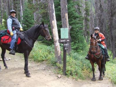
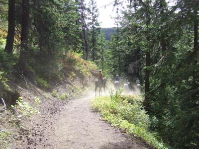
The trail commences at the Windy Joe/PCT/Canyon Nature Trailhead, located 1 km off Hwy 3 on the Gibson Pass (Lightning Lake) road. It heads southeast along the Similkameen trail for just over 2 km before intersecting the Windy Joe trail. (As you travel along the first part of the trail, keep your eyes open for birds. Many species can be seen along here, especially if you begin your hike early in the morning). The trail, which begins its climb here, is an old access road that was previously used to transport people and goods to the fire lookout at the summit. At approximately 3.5 km you will cross a small stream, which is a good spot to stop for a rest and fill your water bottles. A few minutes after passing a second creek you will get your first view of Frosty Mountain, the highest peak in the park (2408 m). In another fifteen minutes, the trail forks (5.5 km), and as indicated by the sign, the left fork continues on to the top of Windy Joe. The right fork is the Frosty Mountain trail which also branches off to the Pacific Crest Trail. The Pacific Crest Trail, which heads south to the Canada - U.S. border, has a wilderness campsite about 20 minutes from the fork. Just metres prior to the summit of Windy Joe, you will notice a large piece of rock at the side of the trail. These conglomerate rocks may be seen in several areas of the park, and were left by retreating glaciers during the last ice age. After an invigorating 2.5 hour ride, the summit is reached at an elevation of 1825 m. At the top there are numerous things to look for. The most obvious, is an old Forest Service fire lookout tower that has been refurbished with an interpretive display of the fire lookout and the surrounding features. The lookout has not been used since 1965, but still offers a magnificent panoramic view, from Frosty Mountain to Blackwall Mountain. Alpine Fir and White-bark Pine abound; the firs have purplish cones which disintegrate on the tree during the winter, and leave only the central spires sticking straight up on the top branches. White-bark Pine have smooth, pale-grey bark and needles in bunches of five. An outhouse is available just before the summit but it may be necessary for you to take your own toilet paper. If you eat lunch here, please be sure to pack out all garbage. The people who come after you will appreciate it.
Note: Also check under Upload/Download tab to see if there are more maps available. If the map below shows red lines, these indicate ridable trails which can be downloaded to your GPS (see Upload/Download tab)
The trail commences at the Windy Joe/PCT/Canyon Nature Trailhead, located 1 km off Hwy 3 on the Gibson Pass (Lightning Lake) road in Manning Park.

Legend

Required
Your email address will not be displayed. This is only so we may contact you if we need to clarify something in your comment.
Required
Required
Required
Note: All of our Geo-Referenced PDF maps are available for free from the Avenza from the Map Store. These maps can be used with the Avenza Maps app on GPS enabled Smartphones and tablets.

GPX Upload
Rode this trail? Show the HCBC Trail Community Which Route You Ride

HCBC monitors the integrity of the GPX files uploaded prior to posting on this website. We will contact you via your email if your track is suitable for an Avenza Map.

Name:

Email:

Please upload GPX files only.


Image Upload
Saw Something Cool? Share it with the HCBC Trail Community

HCBC monitors the integrity of all images and comments posted on this website. Please allow us 24 hours to review the Images uploaded for this trail before they appear on our website. Thank you

Please upload jpeg images only.

Additional files to Download