Greenmax Anglers

Day Ride Trail
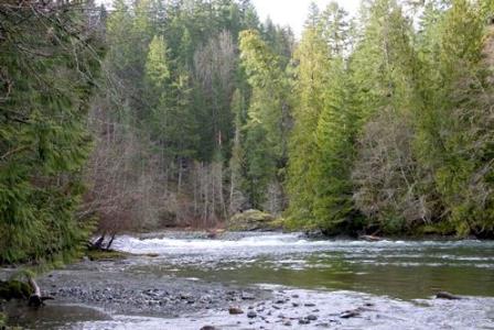
The trail begins by going through the Greenmax woodlot. Follow the road on foot past a cleared area and up a short hill. At the top of the hill take the spur wbicb bears around to the right and follow it to the end at the top of a steep bank above the river. The trail leads down to the river just below the falls opposite the site of the former Girl Guide cabin. From here the trail continues upriver for 2.4 km through a mature second growth forest. At 1.7 you pass one of the more popular swimming spots on the river. The trail continues up river and ends at a popular fishing spot referred to as Eagle Rock.
Port Alberni, Vancouver Island
4.1 km
50 m.
3 hrs return
49.183483
-124.541508
No
Note: Also check under Upload/Download tab to see if there are more maps available. If the map below shows red lines, these indicate ridable trails which can be downloaded to your GPS (see Upload/Download tab)
From the Visitors Information Centre, take the exit on the north side of the Visitor's Centre parking lot and tum left on Highway 4. Drive 4.2 km through town to the T- intersection by the river at the foot of Johnston Road. Tum right and follow Highway 4 (Pacific Rim Highway) along the river and across the Somass River Bridge and out of town. At 12km, afier crossing the Sproat River Bridge, tom right onto Coleman Road. Continue past Airport Road, dowo a hill and across a creek.

Legend

Required
Your email address will not be displayed. This is only so we may contact you if we need to clarify something in your comment.
Required
Required
Required
Note: All of our Geo-Referenced PDF maps are available for free from the Avenza from the Map Store. These maps can be used with the Avenza Maps app on GPS enabled Smartphones and tablets.

GPX Upload
Rode this trail? Show the HCBC Trail Community Which Route You Ride

HCBC monitors the integrity of the GPX files uploaded prior to posting on this website. We will contact you via your email if your track is suitable for an Avenza Map.

Name:

Email:

Please upload GPX files only.


Image Upload
Saw Something Cool? Share it with the HCBC Trail Community

HCBC monitors the integrity of all images and comments posted on this website. Please allow us 24 hours to review the Images uploaded for this trail before they appear on our website. Thank you

Please upload jpeg images only.

Additional files to Download