Mosquito Lake Recreational Site Access

Day Ride Trail
Pemberton
Lake loop, Rock'n Roll, Econoline, Dead Birch, Mr. Roger's, JK Traverse
Approx 9 km
750 ft
2-3 hours
50.32085
-122.75779
Yes
Yes
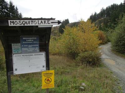
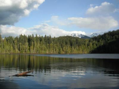
Uphill access from valley bottom to Mosquito Lake and around the lake. The trail above the lake is on crown land and offers great views and open areas. The Mosquito Lake recreational site is an amazing swimming place for riders, but not for horses. Choose the north side dock for a rest with your horse so that you'll be able to see your horse if you choose to go swimming. Water is easy access for horses to drink from the lake. The ride around the lake is on a flat forest service road. Watch for vehicle traffic. Amenities include outhouses and garbage bins.
Note: Also check under Upload/Download tab to see if there are more maps available. If the map below shows red lines, these indicate ridable trails which can be downloaded to your GPS (see Upload/Download tab)
From Highway 99: Do not enter Pemberton downtown; instead, keep going straight toward Mt. Currie. Press your odometer as you pass the traffic light in Pemberton and at 2.6km head left at a junction road. 0.7km further ahead you will pass a railway track. Go 300 ft further and you will see a large parking lot on your left side for recreational users. This is the recommended place to park since the MacKenzie Forest Service Road becomes rougher and is not suitable for horse trailers. Once you've parked, tacked up, and mounted your horse, ride out on the Forest Service road. About 0.6 km uphill there are several trails on private land. Crown land access is on the Forest Service Road further along. Keep going up a total of 1.5 km and then turn right. You will then keep going until you see a residential road calld Linda Road. Go straight past the 4-way and at 2.4 km you will see the Mosquito Lake Recreation Site sign. Make sure to keep right.

Legend

Required
Your email address will not be displayed. This is only so we may contact you if we need to clarify something in your comment.
Required
Required
Required
Note: All of our Geo-Referenced PDF maps are available for free from the Avenza from the Map Store. These maps can be used with the Avenza Maps app on GPS enabled Smartphones and tablets.

GPX Upload
Rode this trail? Show the HCBC Trail Community Which Route You Ride

HCBC monitors the integrity of the GPX files uploaded prior to posting on this website. We will contact you via your email if your track is suitable for an Avenza Map.

Name:

Email:

Please upload GPX files only.


Image Upload
Saw Something Cool? Share it with the HCBC Trail Community

HCBC monitors the integrity of all images and comments posted on this website. Please allow us 24 hours to review the Images uploaded for this trail before they appear on our website. Thank you

Please upload jpeg images only.

Additional files to Download