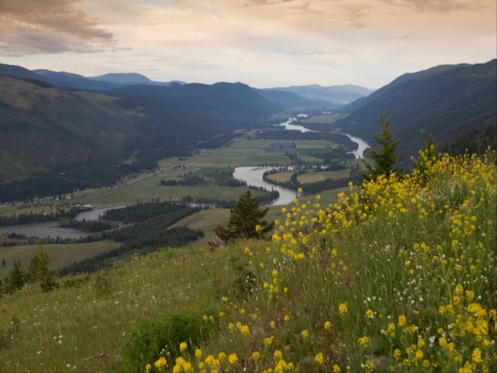
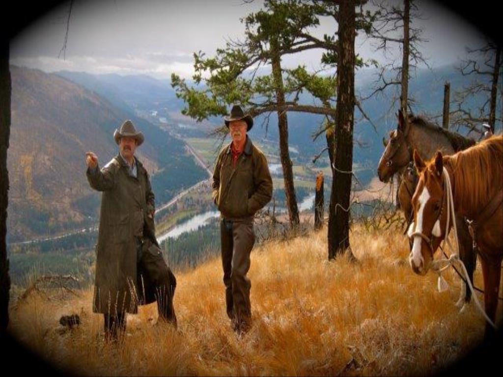
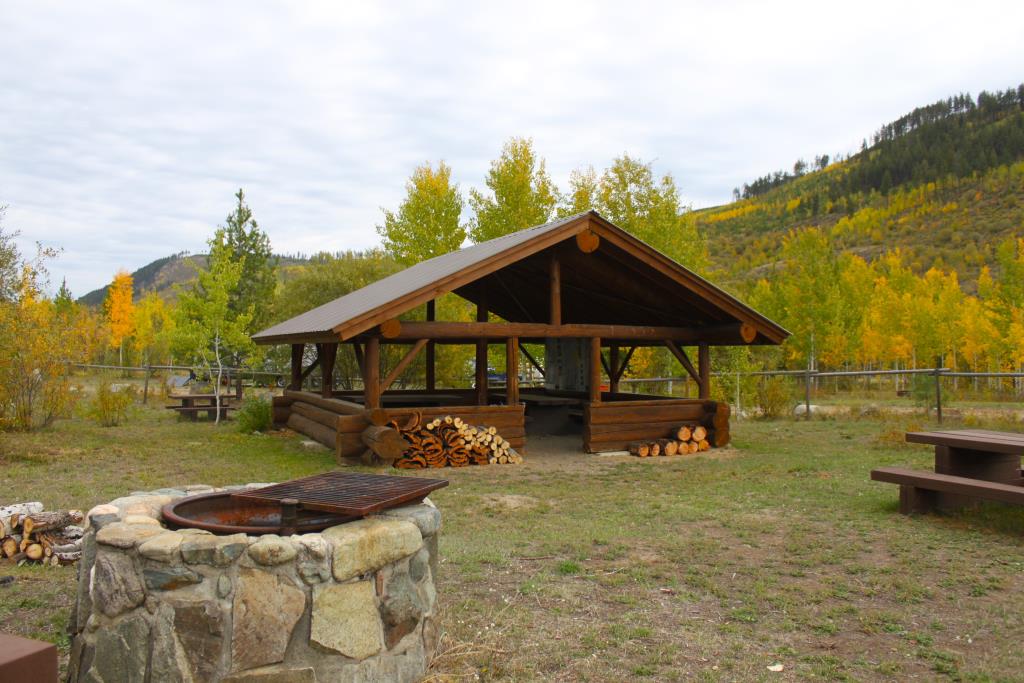
Fishtrap Campsite and Trails
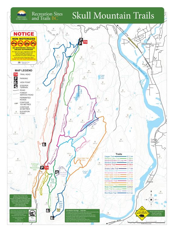
Horse Camping Site
Fishtrap recreation camp site was built in 2009-2010 by Back Country Horsemen - N Thompson Chapter. This project started after the 2003 Wildfires and has developed into a true passion of some dedicated horse enthusiasts to build a camping spot and starting point for the horse and hiking trails. The site is a First Come First Serve, no camp host on site and no fees. The site continues to improve with a new Mountain Trail Course, large fenced area to practice skills and kms of trails. Back Country Horsemen maintains the campsite and trails through a Partnership Agreement with Rec Sites & Trails BC. Fishtrap Campsite is located at 12.5 km on Westsyde Road, just west of Barriere, BC. The Skull Mountain Trails network boasts 125+ kms of trails from the Fishtrap campsite.
Barriere
Skull Mountain Trails, Seven Sisters Trail System
125 kms of Trail
On average about 1000 feet
51.11887
-120.214909
Fishtrap Creek runs right close to the campsite and corrals. Water horses at creek or bucket over to site.
The campsites are set up in a circular fashion so you can pull ahead and drive right out again. There is room for at least 20 rigs.
The campsite has 16 corrals; nine are 22x22 and six are 12x20. It is fully equipped with 3 outhouses, and shower house (you bring your own bag), a 20x20 shelter, picnic tables and fire rings. Sites a large and can accommodate 1 - 2 rigs. Bring your own fork and wheelbarrow to haul manure over to the pit.
There is a group gathering picnic shelter. Fishtrap Creek runs right beside the camp which is a great water source. There are 11 campsites set up, each with their own corral. At this point there is no advance booking required. There are cowboy corrals on the other side of the creek for overflow. The trails for the most part are moderate difficulty trails. This is a fairly rocky area, so shoes or boots are recommended. Skull Mountain Trail network offers 125 kms of well maintained trails accessible from camp. Check out the Skull Mtn Trail map . Also see Seven Sisters area trails maps . See Tab - Files Maps Upload/Download. Geo-referenced map is available through the Avenza App - Horse Council BC Skull Mtn Equine Trails
Note: Also check under Files Maps Upload/Download tab to see if there are more maps available. If the map below shows red lines, these indicate ridable trails which can be downloaded to your GPS (see Files Maps Upload/Download tab)
Access from Barriere: Travel north from Barriere on Highway 5 for .5 km, cross the bridge and turn left onto Westsyde Road. The road climbs for 4 km and then levels out. This is a well maintained secondary road. At 12.5 km you will see the Fisthrap campsite on the left side. It is clearly visible from the road. From Kamloops: Travel Westsyd eRoad 50 km to the McLure Ferry and continue on for another 10 km. Cross Fishtrap Creek and Fishtrap Campsite is immediately after it, on the right hand side.

Legend

Patricia Skinner

Celebration! posted on: 08 / 27 / 2025

LOVE this spot! Beautiful large paddocks, creek right out back, firepits, lovely picnic tables, shade trees, clean shower and outhouses even have wall prints! Super trails and so impressed with the mountain trail course - quite the project to turn out that amazing suspension bridge obstacle. Great work and thank you! Only negative is that hoary allysum is everywhere so be careful grazing.


Linda Buchanan

Everything in one camp! posted on: 11 / 22 / 2024

This camp has something for everyone! Lot's of space to camp with large corrals. Fenced areas to warm up your horse before riding out on the many surrounding trails. Or practice your skills on the NEW Mountain Trail Course where there's 25 different challenges for all levels. Great gathering shelter and fire pit area. Hidden GEM!


Wendy London

Camping at Fishtrap posted on: 07 / 22 / 2022

This is the first time we’ve ever been to Fishtrap and the campsite was excellent. There were good size paddocks, a clean outhouse and a creek nearby. The trail riding is fairly rocky and quite hilly. There wasn’t the views that you would get at say Lundbom or Kane. When we were there we had the place practically to ourselves so if you like privacy this is the place to go. There are lots of riding opportunities and miles and miles of trails. We used the BackRoads Mapbook app combined with photos we took of the maps that were on the board. Our partners had quads and said it was awesome quading. The quading is on the one side of the road and the horse riding is on the same side of the road as the campsite. You can ride your horses on the other side as well but you can’t quad on the horse side as the trails are too narrow and steep. The mosquitoes were quite bad so it is a good idea to bring bug spray, a fly sheet and a fly mask for your horse. Also, for trail riding a full set of shoes or boots is a must . We will definitely go back. We also had the pleasure of meeting a couple that lives down the road who are a members of the local Back Country Horsemen chapter. They have done all the work on this place and are very nice people.


Lori Williams

Snake Lake Trail posted on: 06 / 06 / 2022

Beautiful views. Needs a few signs to stay on the trail. Rocky and steep at first but worth it! Recommend shoes. The campsite was very well set up for horses and groups. Watch out for the pipeline workers on Westsyde Rd.jGFRKH


Linda Buchanan

Trail Map available in Avenza posted on: 05 / 10 / 2021

A geo-referenced map is available in Avenza. Search: Horse Council BC Skull Mtn


Required
Your email address will not be displayed. This is only so we may contact you if we need to clarify something in your comment.
Required
Required
Required
Note: All of our Geo-Referenced PDF maps are available for free from the Avenza from the Map Store. These maps can be used with the Avenza Maps app on GPS enabled Smartphones and tablets.

GPX Upload
Rode this trail? Show the HCBC Trail Community Which Route You Ride

HCBC monitors the integrity of the GPX files uploaded prior to posting on this website. We will contact you via your email if your track is suitable for an Avenza Map.

Name:

Email:

Please upload GPX files only.


Image Upload
Saw Something Cool? Share it with the HCBC Trail Community

HCBC monitors the integrity of all images and comments posted on this website. Please allow us 24 hours to review the Images uploaded for this trail before they appear on our website. Thank you

Please upload jpeg images only.