 HCBC
HCBCSouth Chilcotin Mountains Provincial Park Located in the Thompson Okanagan


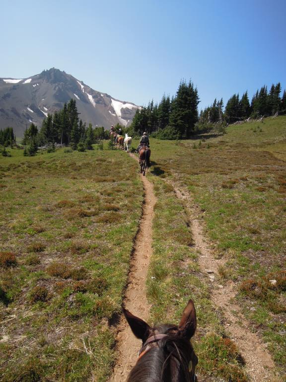
Recent Images
South Chilcotin Mountains Provincial Park
Legend
South Chilcotin Mountains Provincial Park Comments Want To Get Involved? Post Comment
Jewel Creek Protected Area - Bridge Closed posted on: 11 / 19 / 2025
Jewel Creek Protected Area including the Jewel Creek Bridge will remain closed until safe access can be restored. Go to BC Parks website for updates.
Trails in S Chilcotin posted on: 01 / 28 / 2025
Yes there is still access into the S Chilcotin. Best to contact the guide outfitter at Goldbridge for the most current info. https://www.wildernesstrails.ca/ I do know the Gun Creek access is not open but Tyaughton Creek is open as well as the trails from the outfitter.
Horse back riding posted on: 01 / 28 / 2025
Just wondering what trail heads are the best to use for horseback riding into the South Chilcotin since the fires of 2023.
Camping in S Chilcotin posted on: 02 / 10 / 2019
Yes you can pack in and camp at Spruce Lake - Cowboy Camp. Rustic. As for camping in your rig and doing day rides out NO. We were taken in to another area by a guide outfitter and stayed at his base camp.
camping posted on: 01 / 22 / 2019
Are you able to camp in the area and ride out?
Tyaughton Trail, Paradise Trail and Deer Pass Trail posted on: 09 / 09 / 2018
The Tyaughton Trail is for the experienced backcountry rider as it had steep side slopes and can change in wet weather. This trail is 32 km's in length, a 9 hour ride one way with an elevation gain of 2000 feet. The Paradise trail is difficult as you climb from the valley up above tree line. This is 6.5 km approx. 2.5 hour ride one way. The elevation gain is 1900 ft. The views are breathtaking. Deer Pass Trail is a difficult trail. You leave the valley and head up above tree line. This is approximately 10 km's one way to the pass. We didn't make it all the way due to a washout of the trail and is approx 4-4.5 hour ride one way. The elevation gain is 1800 feet. The views are spectacular up here. 360 degrees of mountains all around you.
GPX Upload
Rode this trail? Show the HCBC Trail Community Which Route You Ride
HCBC monitors the integrity of the GPX files uploaded prior to posting on this website. We will contact you via your email if your track is suitable for an Avenza Map.
Name:
Email:
Image Upload
Saw Something Cool? Share it with the HCBC Trail Community
HCBC monitors the integrity of all images and comments posted on this website. Please allow us 24 hours to review the Images uploaded for this trail before they appear on our website. Thank you


