Mount Rose-Swanson

Day Ride Trail
A lovely variety of forested trail loops, to several smaller summits, and rock bluffs, overlooking the Spallumcheen Valley above Armstrong. Mt. Swanson is accessed from the trail heading south from the right/west entrance of the parking area, and Mt. Rose is accessed from the trail on the left/east side. The two trails join to make a large loop, with one alternate side loop off the Mt Swanson trail creating an option for extend ride.
Armstrong, BC
None
50.2703
-119.1505
No
Parking is very limited with space for 3 trucks/trailers. This is a popular hiking area.
Suggested route is to take the trail to the right from the parking area. This is a wide trail and steady climb. At 1500 metres you can continue straight up to the Tower Viewpoint which has amazing views. Or you can take the Red loop to the right. This section of trail has very difficult sections with shear rock and narrow steep rocky sections. You may want to dismount to navigate. The loop is single track and also has some nice views and you will arrive at the Tower Viewpoint. From the Tower head back on a beautiful single track trail to the parking area. It is NOT recommended to ride the loop from the tower viewpoint to the left. This is for hikers as it is very narrow and steep with switchbacks. Bring your lunch and enjoy the views. There is an outhouse at the Tower. You will also meet hikers on these trails.
Note: Also check under Upload/Download tab to see if there are more maps available. If the map below shows red lines, these indicate ridable trails which can be downloaded to your GPS (see Upload/Download tab)
Heading south on Hwy 97 at Armstrong, take the Pleasant Valley Blvd entrance into town, then take the first right hand turn across the tracks, the second left turn onto Wood Ave and continue up the hill and across the tracks where the road becomes the Salmon River Road. Continue west on Salmon River Road out of Armstrong for about 4 km, Traveling through three right angle turns in the road, before you come to Hallam Rd. Turn left onto Hallam Rd, continuing for approx. 2 km, through two more right hand turns and winding road. As the road heads into the next corner, look for Chamberlain Road heading south on your left. Watch for traffic as you make the sharp turn back onto Chamberlain, continuing south along the now gravel road around another right angle bend for approx. 2 km, staying left at the fork, and looking for the parking area on your left a few hundred metres further on.

Legend

Rose Schroeder

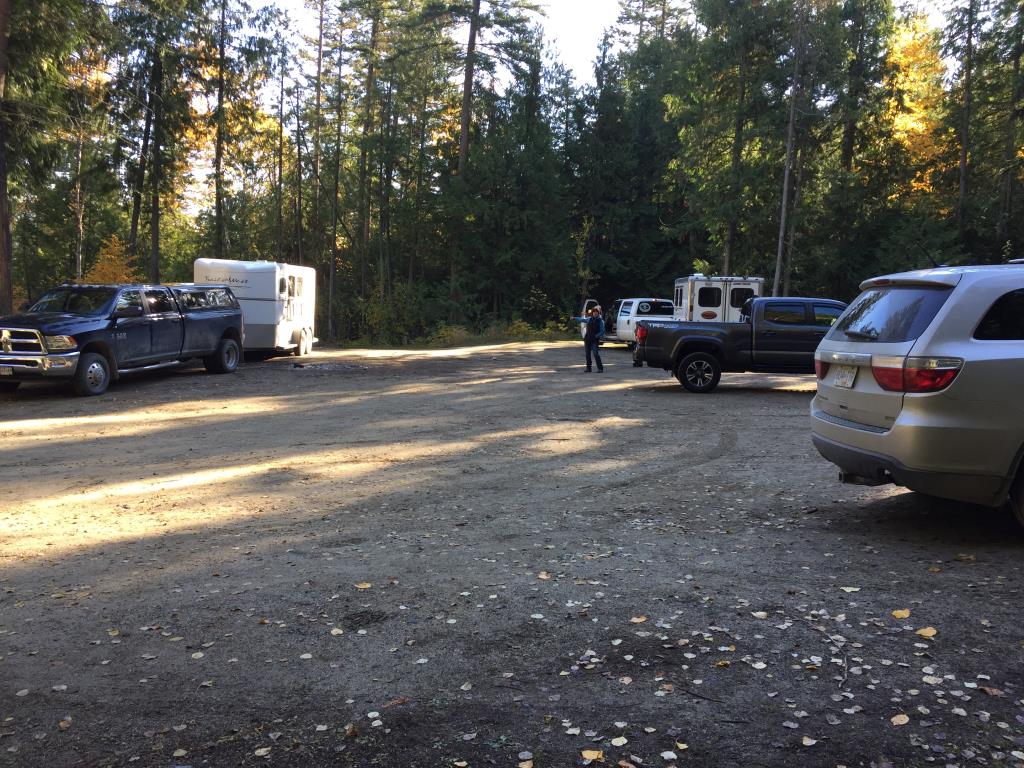
Mt Rose Swanson Trail head posted on: 11 / 01 / 2022

From the Mt Rose Swanson trailhead on Chamberlain Rd out of Armstrong you can ride both the Mt Rose trail network and the Mt Swanson trail network


Admin

Horse Week Trail Days posted on: 09 / 22 / 2022

The Shuswap Chapter of BCHBC is organizing a Horse Week Trail Days to take place at the Mt Rose Swanson Trail network October 16-22. On Sunday, October 16th and Saturday, October 22nd guided trail rides will be taking place and an information booth will be setup.


Linda Buchanan

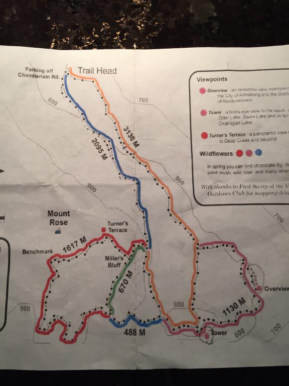
Paper Map posted on: 11 / 24 / 2018

The paper map gives accurate distances. It is not recommended to ride the Green or Pink sections as they are not horse friendly. The red loop has some very difficult and technical sections, you can always get off and lead. It makes for a longer ride.


Required
Your email address will not be displayed. This is only so we may contact you if we need to clarify something in your comment.
Required
Required
Required
Note: All of our Geo-Referenced PDF maps are available for free from the Avenza from the Map Store. These maps can be used with the Avenza Maps app on GPS enabled Smartphones and tablets.

GPX Upload
Rode this trail? Show the HCBC Trail Community Which Route You Ride

HCBC monitors the integrity of the GPX files uploaded prior to posting on this website. We will contact you via your email if your track is suitable for an Avenza Map.

Name:

Email:

Please upload GPX files only.


Image Upload
Saw Something Cool? Share it with the HCBC Trail Community

HCBC monitors the integrity of all images and comments posted on this website. Please allow us 24 hours to review the Images uploaded for this trail before they appear on our website. Thank you

Please upload jpeg images only.

Geo-Ref maps for Avenza Maps App on mobile devices

Note: If you are on a computer, you can print these maps. If you using a mobile device, then these maps are available to download from the Avenza Map Store within the Avenza app.