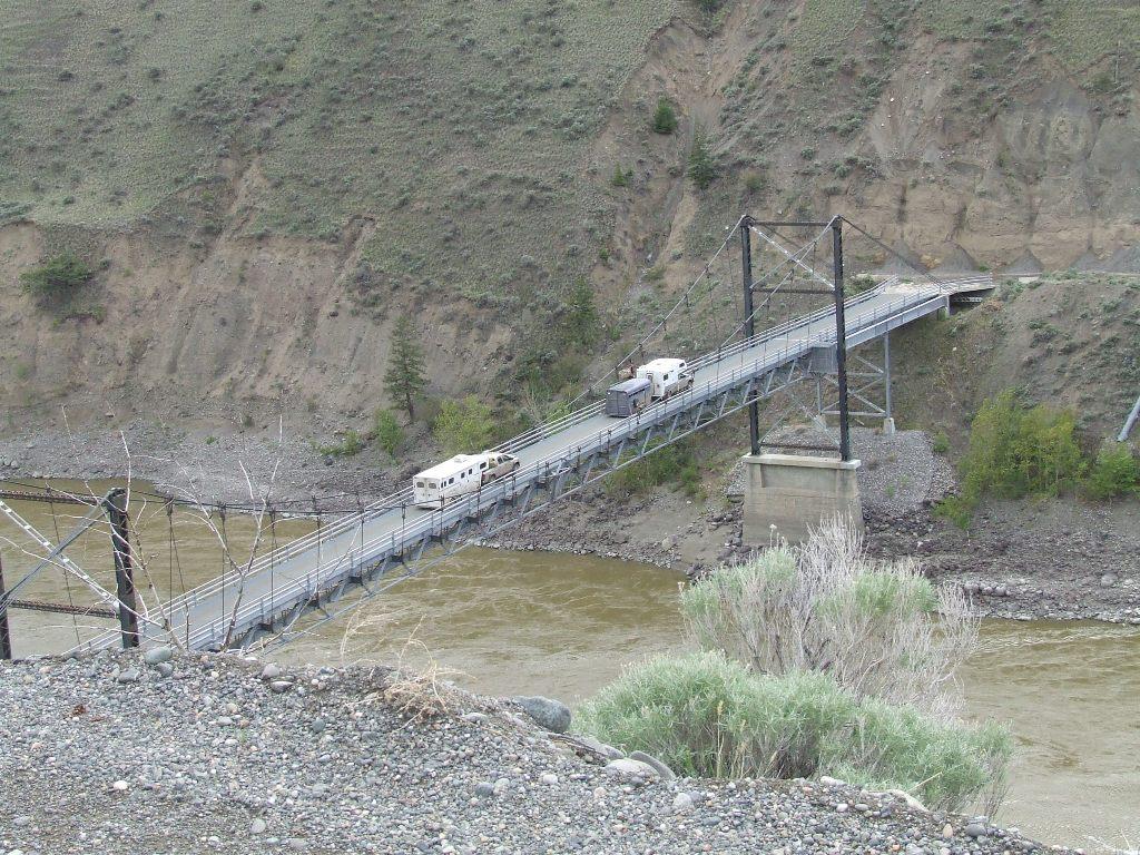
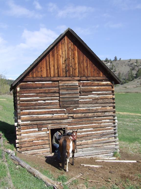
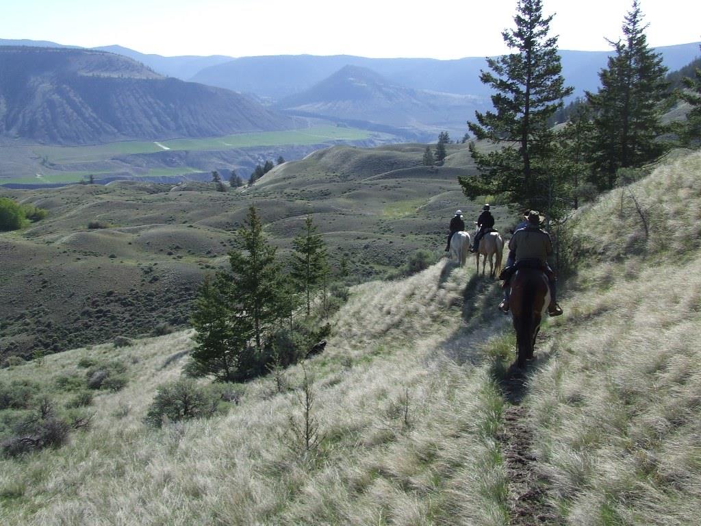
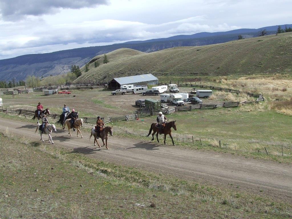
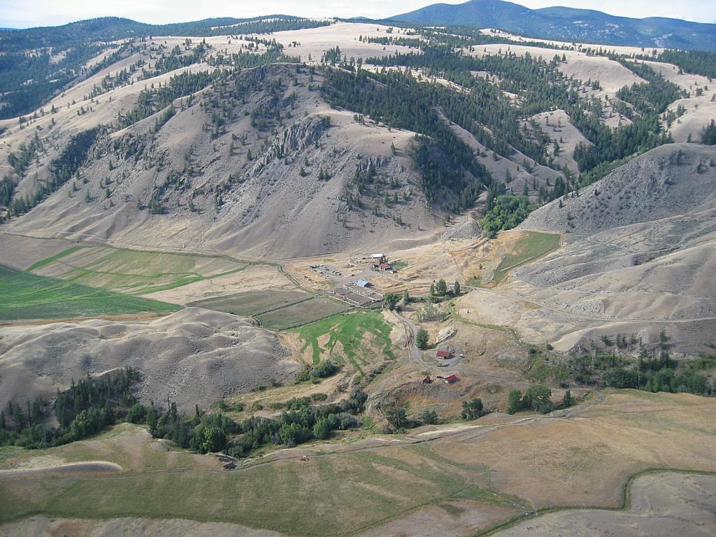
Churn Creek Protected Area/Empire Valley

Horse Camping Site
The Churn Creek Protected Area is 36,100 hectares of bunchgrass and pine and fir forests. It has a rich history of First Nations People, packers, miners and industrious Chinese, whose ditch work can still be seen today. Ranching has been going on here since the early 1860's. Since 1998, it has included the Empire Valley Ranch, a family operated cattle ranch, within the Protected area. There is camping at the Calving Barn which includes a pit toilet, corrals and a spring approximately 150 yards from the campsite. The spring has been known to go dry. Riding is spectacular through open hayfields and rangeland. Trails are not marked. if you head up onto one of the plateaus you will be rewarded with specatular views looking owed on the Fraser River. Please leave all gates as you found them.
Clinton, Quesnel
51.440124
-122.275662
Yes, small spring but be prepared to bring your own water for horses.
Yes
There is plenty of room to set up camp around the calving barn. The barn is a good place to gather or get out of the weather. There are 8 large corrals behind the barn. Bring your own hay and water. You are within the Protected Grasslands so no grazing.
Be prepared to wait out the weather as the roads get extremely slippery when wet. The local rancher uses chains on their truck when it gets like this. If you head south down the road and pass through the gate you can make your way around the right to Brown Lake and continue to BC Lake. Or head further south along Brown Lake, cross the road and turn up an old road on the left to get up onto the plateau of Clyde Mtn. Or head north from camp and head down to the Fraser River. The steeps are steep! Look at the contour lines on a topo map.
Note: Also check under Files Maps Upload/Download tab to see if there are more maps available. If the map below shows red lines, these indicate ridable trails which can be downloaded to your GPS (see Files Maps Upload/Download tab)
The Churn Creek Protected Area is a remote area, north and west of Clinton B.C. It is reached by following the Meadow Lake Road, 70km west, out to the Fraser River, crossing the river on the metal bridge and taking the left fork to Empire Valley (right fork goes to the Gang Ranch). Camp is 12 kms from Churn Creek bridge crossing. The road is gravel with many steep switchbacks getting down to the bridge and then back up the other side. There are other options coming in from the north.

Legend

Rose Schroeder

update on recent visit to Churn. posted on: 07 / 12 / 2025

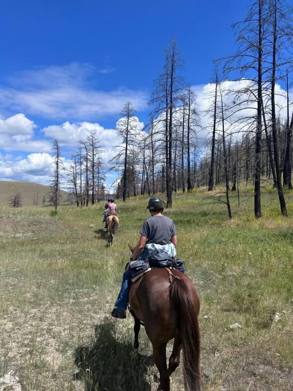
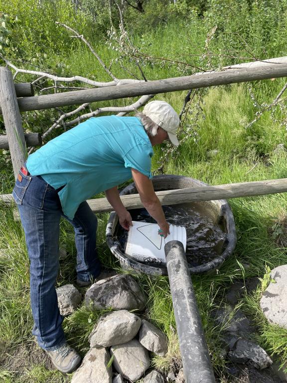
stunning place to viist, ride and camp with horses. Everything was in good shape as far as the corrals, barn and outhouse. Water was scarce at the creek so we had to go up the road and fill containers at the creek. Really no bugs other than gnats that chew the horses underbellys, and ears if not sprayed or Vic Vapo rub also works........... Constantly check the weather as the road is impassable by truck and trailer if its wet.


Linda B

July 2025 visit posted on: 07 / 12 / 2025

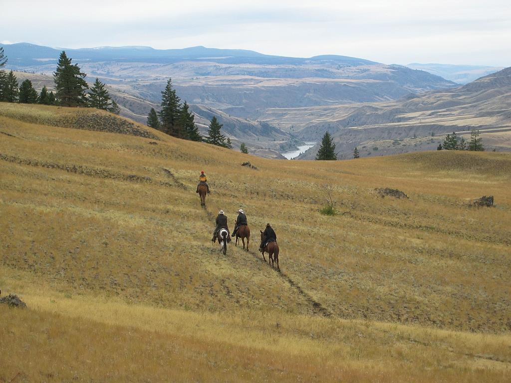
A group of BCHBC members headed into churn for some spectacular riding. I haven't been in here for over 10 years. Some changes since the forest fire went through but the scenery is still breathtaking. 8 Nice large corrals have been built behind the calving barn. The water source .5 km from the barn was not looking good. Just a trickle so be prepared to haul in your own water. This was my first time actually driving a rig in. Yes I white knuckled it all the way down, not for the faint at heart. We did pull out a day early as the weather was changing to some rain and I had already experienced the slick roads before. Such an amazing territory to explore.


Rose Schroeder

Churn Creek/Empire Valley posted on: 09 / 11 / 2009

take a good topo map. Trails are not marked, most are cattle paths or sheep trails, old logging and mining roads. Instead of hauling water all the way from the ranch, if the spring is dry there is a good watering trough up on the hill across from camp back to the north. July 2025 - unable to located this water trough.


Required
Your email address will not be displayed. This is only so we may contact you if we need to clarify something in your comment.
Required
Required
Required
Note: All of our Geo-Referenced PDF maps are available for free from the Avenza from the Map Store. These maps can be used with the Avenza Maps app on GPS enabled Smartphones and tablets.

GPX Upload
Rode this trail? Show the HCBC Trail Community Which Route You Ride

HCBC monitors the integrity of the GPX files uploaded prior to posting on this website. We will contact you via your email if your track is suitable for an Avenza Map.

Name:

Email:

Please upload GPX files only.


Image Upload
Saw Something Cool? Share it with the HCBC Trail Community

HCBC monitors the integrity of all images and comments posted on this website. Please allow us 24 hours to review the Images uploaded for this trail before they appear on our website. Thank you

Please upload jpeg images only.

Additional files to Download