 HCBC
HCBCRainbow Trails Located in the Thompson Okanagan


Recent Images
Rainbow Trails
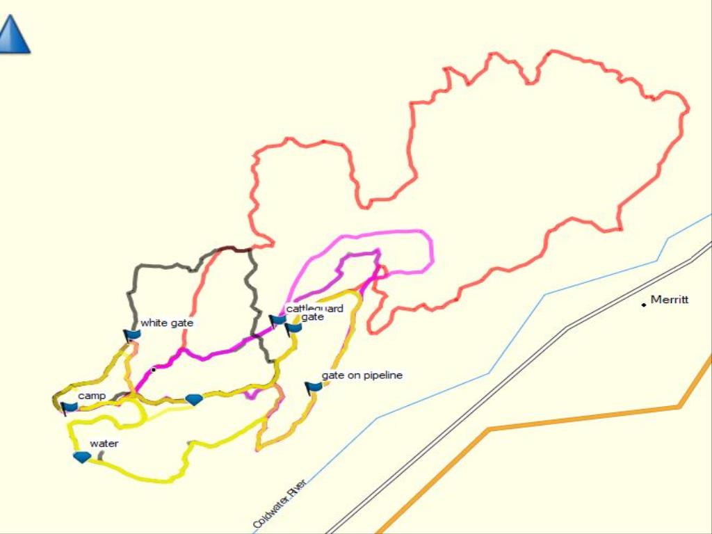
Legend
Rainbow Trails Comments Want To Get Involved? Post Comment
Rainbow Camping Meadow posted on: 04 / 25 / 2022
April 21, 2022 checked the Rainbow meadow camping area. All is in good shape. There is spring runoff water running at the east end so the ground is very wet and should be avoided until it dries up. The water tank is not in operation at this time. The road in was in excellent shape. Lots of construction on the Coldwater road for the pipeline. Expect some delays and trucks.
Rainbow trails posted on: 06 / 06 / 2018
The short and long white trail are now cleared. The pink trail is also cleared. Bring a saw anyway as any new wind storm brings new windfall.
Rainbow Trails posted on: 06 / 04 / 2018
I see that the description says no amenities: there are 2 outhouses at the Rainbow Meadow campsite. BCHBC Yarrow was there on the long weekend clearing windfall. There is much more to do but most trails you can get through if you go around stuff. Trails are not as well marked as they used to be but can still be followed by colored horseshoes, ribbon and common sense. ERABC does have gps'd coordinates.
GPX Upload
Rode this trail? Show the HCBC Trail Community Which Route You Ride
HCBC monitors the integrity of the GPX files uploaded prior to posting on this website. We will contact you via your email if your track is suitable for an Avenza Map.
Name:
Email:
Image Upload
Saw Something Cool? Share it with the HCBC Trail Community
HCBC monitors the integrity of all images and comments posted on this website. Please allow us 24 hours to review the Images uploaded for this trail before they appear on our website. Thank you


