Golden Ears Provincial Park Located in the Fraser Valley
Golden Ears Provincial Park
Legend
Golden Ears Provincial Park Comments Want To Get Involved? Post Comment
hecter fergusen lake posted on: 07 / 09 / 2016
has anyone climbed up there this year. only horse access to gold creek and hf crk for horses.
East Canyon Trail posted on: 07 / 21 / 2013
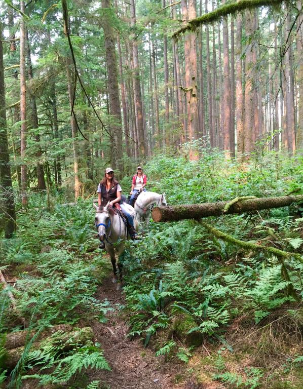
There are tons of riding opportunities at Golden Ears of varying difficulties. For a ~10k return trip of low intensity with a nice destination, try the East Canyon Trail. To access this trail, park at the Gold Creek lot. (Drive all the way to the end of the main road, follow it as it turns to gravel and cross the one-lane bridge. Park in the northeastern--upper-- most lot, which is roughly circular and easy to park a trailer.) From here, you will see a trail take off from the NE corner of the lot. This is a short connector trail that will take you to the East Canyon Trail, where you will need to take a left (head north). The trail was once a logging road, so large gravel and smooth stony sections are common. There are no boulders, but most horses will need foot protection. The trail is relatively wide and has a very gentle grade through the forest. At around ~4.5 km there is an outhouse to your right and shortly thereafter the trail forks. Take the fork to the left to get to Viewpoint Beach. This is a river-rock beach, and there are slower sections of river in the summer such that you can cross the other side, which has a more sandy beach and is a good picnic spot. The view of Mt. Blanshard here is very nice. Technically the trail continues past this spot for several kilometers, but it does turn into a rough/narrow trail, and the beach is a good turn around point. Go early as this is a multi-use trail, and the trailhead can get very busy later in the day. Strong fly spray is a must as there can be some bugs in the shade near the water. This ride takes a few hours and is not difficult fitness-wise.
horse owner posted on: 03 / 25 / 2011
we were unable to ride the part of the maple ridge trail at the bottom of the road/hill just past the fire hydrant because trees had fallen and are blocking the trail. does anyone know if there is regular maintenance on this part of the trail?
GPX Upload
Rode this trail? Show the HCBC Trail Community Which Route You Ride
HCBC monitors the integrity of the GPX files uploaded prior to posting on this website. We will contact you via your email if your track is suitable for an Avenza Map.
Name:
Email:
Image Upload
Saw Something Cool? Share it with the HCBC Trail Community
HCBC monitors the integrity of all images and comments posted on this website. Please allow us 24 hours to review the Images uploaded for this trail before they appear on our website. Thank you
 HCBC
HCBC


