 HCBC
HCBCAldergrove Lake Park Located in the Fraser Valley


Recent Images
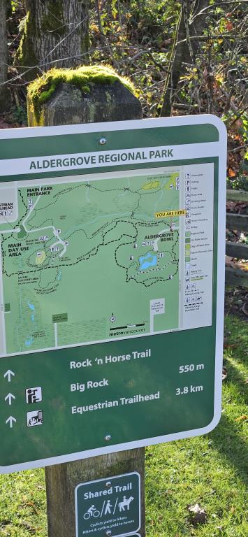
Aldergrove Lake Park
Legend
Aldergrove Lake Park Comments Want To Get Involved? Post Comment
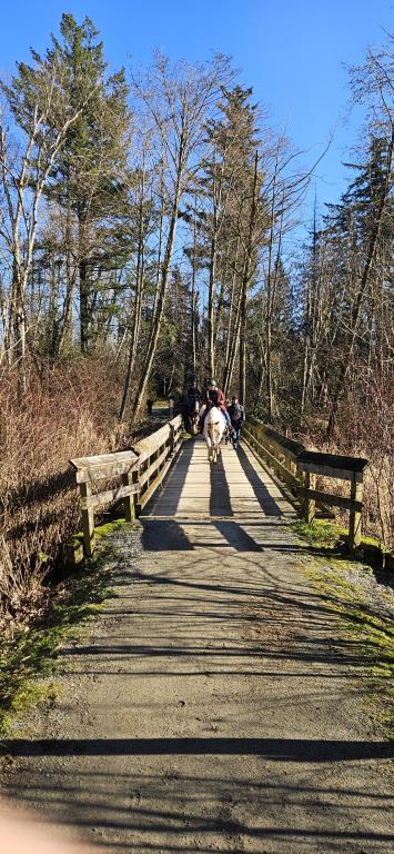
Bridge width posted on: 08 / 03 / 2022
Are the bridges wide enough for a cart?
Bridge width posted on: 08 / 03 / 2022
Are the bridges wide enough for a cart?
Nice day at Aldergrove Park posted on: 04 / 25 / 2014
The trails are in great shape this spring
Aldergrove Lake Loop posted on: 07 / 21 / 2013
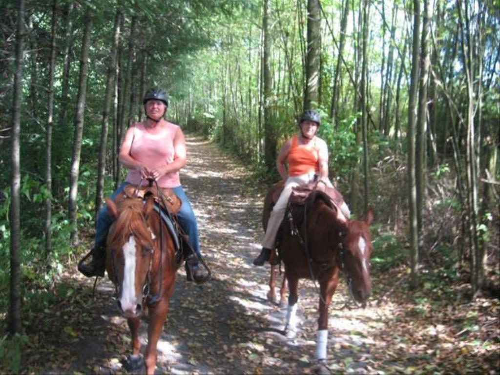
Aldergrove Lake is a lovely couple hour ride. There are mounting logs at the start of the trail in the parking lot (handy), and this is the only place the trail takes off (very easy to find). The majority of the trail is wide, and it is gravel or crusher dust footing much like Campbell Valley. There are two moderate downhill sections (one of which is an uphill on the return), but most of the trail is relatively gentle. There are a few wooden bridges.The scenery is lovely. Much is in the trees, but there is a nice grassy open "bowl" at one section of the ride and there is wonderful view of Mt. Baker at another section. The loop is shorter than Campbell Valley and really about the perfect length for those who like to walk only. In my opinion there tend to be more people (hiking/dog walking) at certain sections of the trail than in Campbell Valley, but otherwise the setting is similar.
GPX Upload
Rode this trail? Show the HCBC Trail Community Which Route You Ride
HCBC monitors the integrity of the GPX files uploaded prior to posting on this website. We will contact you via your email if your track is suitable for an Avenza Map.
Name:
Email:
Image Upload
Saw Something Cool? Share it with the HCBC Trail Community
HCBC monitors the integrity of all images and comments posted on this website. Please allow us 24 hours to review the Images uploaded for this trail before they appear on our website. Thank you


