Kakwa Provincial Park & Protected Area

Back Country Trail
Kakwa Provincial Park showcases iceclad mountains, extensive alpine meadows and a section of the Continental Divide. Main physical features include Mount Sir Alexander (3270 m), Mount Ida (3189 m) and Kakwa Lake. Summer activities include camping, hiking, fishing, and horseback trips. Recommend Tania Millen's book: Pack em up, Ride em Out for her pack trip into Kakwa Park. Recommended Intermediate to Advanced difficulty, ideal month is August.
McBride, Prince George, Valemount
Yes for advanced riders with route finding skills.
170 km
8+ days
54.057778
-120.29534
Bring your own drinking water. Potable water not available.
There are two areas at the south end of Kakwa Lake that have been designated for camping: one is for hiker traffic (West side of Wapumun Creek) and the other is for horse traffic (East side of Wapumum Creek). These sites each have a pit toilet and fire circle, horse users are requested to cross Wapumun Creek at one specially marked location only : at the blue bamboo poles near the north end of the creek where it flows into Kakwa Lake. The creek is a crucial spawning creek for the Rainbow trout that inhabit Kakwa Lake, and horses crossing along the creek would damage the spawning beds. Horse users please avoid this area with your horses as this area is a source of drinking water for park visitors. The park is a user maintained park, so pack out whatever you have packed into the park. Please cooperate and help to keep the park pristine for future visitors.
Horseback riding is permitted in Kakwa Provincial Park. Horse users please do not let horses swim in the lake in front of the cabin as this area is a source of drinking water for park visitors. The park is a user maintained park, so pack out whatever you have packed into the park. Please cooperate and keep the park pristine for future visitors. For more information and important visitors notices visit the BC Parks website .
Note: Also check under Files Maps Upload/Download tab to see if there are more maps available. If the map below shows red lines, these indicate ridable trails which can be downloaded to your GPS (see Files Maps Upload/Download tab)
Located approximately 70 km north of McBride in British Columbia. The Kakwa Provincial Park can be accessed from McBride in B.C., Grand Prairie in Alberta, or by air charter.

Legend

Eileen MacDonald

nearby trails posted on: 01 / 15 / 2025

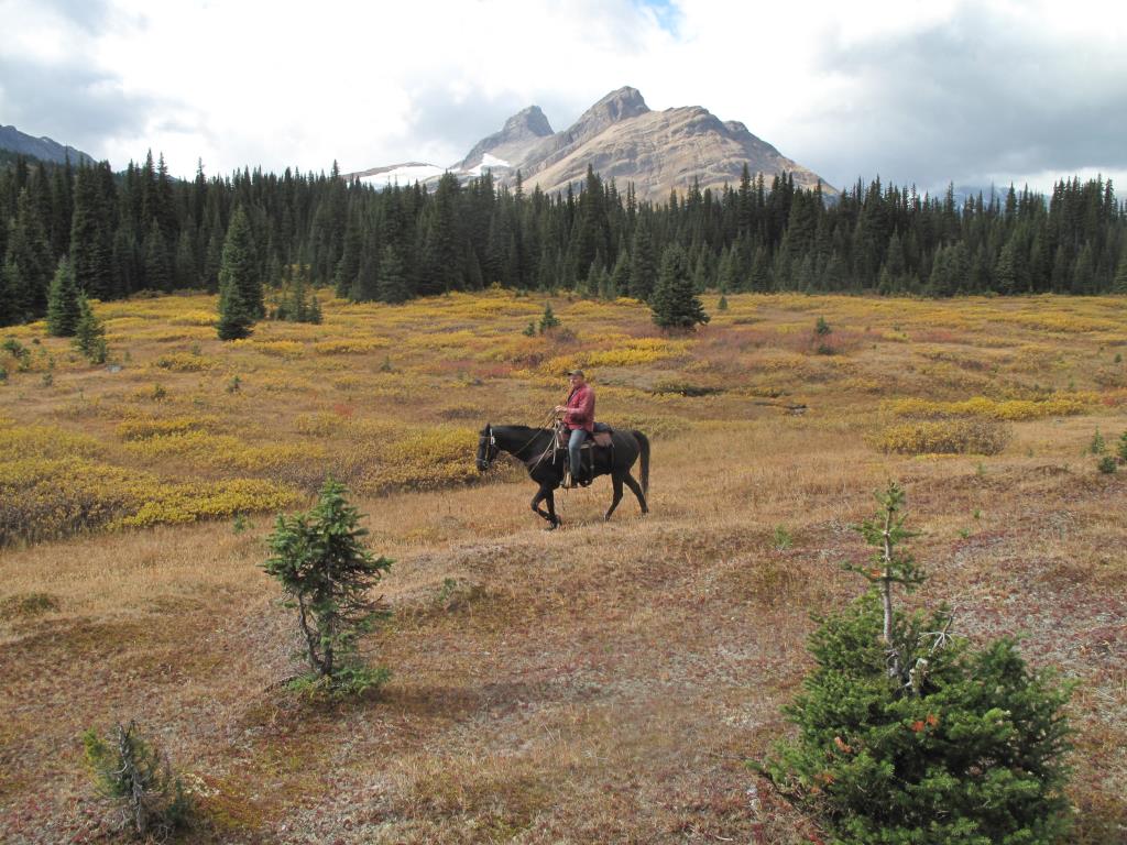
The Kakwa is an entrance/exit onto/off of remote section G of the Great Divide trail (GDT). The GDT was oriiginally a rugged backcountry horse route used by pioneers and outfitters and is still travelled by backcounry horse enthusiasts today.. The GDT traverses over many passes along the divide and extends as a vast wilderness trail from uinterupted by roads from Kakwa through the West Wilmore Wilderness with exits/entrances at Blueberry close to McBride or at Decoyne near the west highway gate of Jasper Park. . .


Required
Your email address will not be displayed. This is only so we may contact you if we need to clarify something in your comment.
Required
Required
Required
Note: All of our Geo-Referenced PDF maps are available for free from the Avenza from the Map Store. These maps can be used with the Avenza Maps app on GPS enabled Smartphones and tablets.

GPX Upload
Rode this trail? Show the HCBC Trail Community Which Route You Ride

HCBC monitors the integrity of the GPX files uploaded prior to posting on this website. We will contact you via your email if your track is suitable for an Avenza Map.

Name:

Email:

Please upload GPX files only.


Image Upload
Saw Something Cool? Share it with the HCBC Trail Community

HCBC monitors the integrity of all images and comments posted on this website. Please allow us 24 hours to review the Images uploaded for this trail before they appear on our website. Thank you

Please upload jpeg images only.