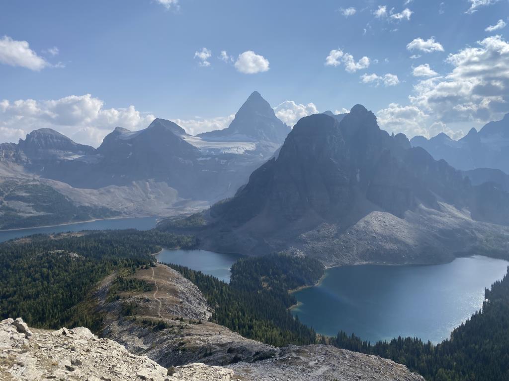
Mount Assiniboine Provincial Park

Provincial Park
Mount Assiniboine is located in the triangle between Banff, Canmore and Radium Hot Springs, on the BC side of the continental divide. The peak soars over 3,600 m and with its distinctive pyramid shape is one of the most recognizable peaks in the Rockies. Historically, First Nations used the area extensively, which is documented in photos of tipis situated on the shores of Lake Magog. Early explorers, mountaineers and tourists accessed the area by horse and in 1922, the area was designated a provincial park. Commercial horse pack trips are not currently available to the park, which is used almost exclusively by hikers. However, permission to ride horses in the park is easily acquired from BC Parks. If you’re interested in learning more: Check out Tania Millen’s book Pack‘em Up, Ride‘em Out. http://www.taniamillen.com
Banff, Invermere, Radium Hot Springs
7 day loop ride
50.93723
-115.760726
Creeks and rivers
Some BC Parks shelter/cabins. May have limited grazing or corrals. Suggest pack supplemental horse feed.
For those travelling into Mt. A via Mt Shark, they will need to check permit requirements for Banff National Park as the trail traverses a short section of the park. And/or camp at Tall Timbers in BNP for a shorter day (about 15 km) into OBrien. Also well worth riding up to Allenby Pass for a side trip although there are annual restrictions on horses/hikers due to high grizzley population. Mt Shark is the 'usual' route for hikers into Mt. A, is easy, and only 24 km from the trailhead at Mount Shark to the O'Brien horse campsite. Basic route finding required down the Simpson River from Police Meadows to Surprise Creek. If planning to horseback ride in the park, we recommend you read the Mount Assiniboine Horse Use Policy [PDF 470KB] and view/print the Horse Trail Map . [PDF 286KB] As horseback riders are required to obtain and carry with them a letter of permission from BC Parks. Please note that there is no horse access to Assiniboine Lodge, the Naiset Cabins, Wonder Pass, or Citadel Pass.
Note: Also check under Files Maps Upload/Download tab to see if there are more maps available. If the map below shows red lines, these indicate ridable trails which can be downloaded to your GPS (see Files Maps Upload/Download tab)
The easiest access is via Mount Shark XC ski trails located 45 km south of Canmore. There's lots of parking at the trailhead but no overnight camping. The nearest horse camping is at Banff Trail Riders in Banff ($20/night per pen). But humans can't camp there - they need to book into a national park campsite ;) Or camp at Etherington Horse Camp in AB, about 100(?) km south.

Legend

Brent Wray

Booking O'Brien Horse Camp posted on: 03 / 16 / 2026

Process confirmed. Book thru Assiniboine Lodge. Send email with dates, # people, # horses. No fees, they just need to know who's there, in case of emergencies. This requirement is in addition to Letter of Permission.


Brent Wray

2025 ride posted on: 01 / 17 / 2026

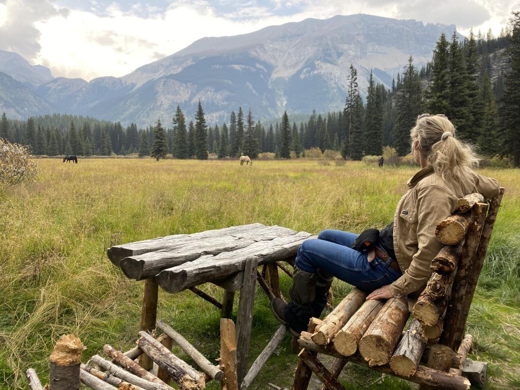
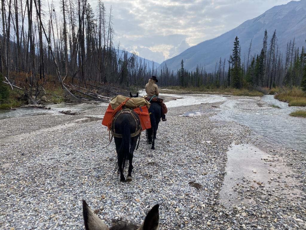
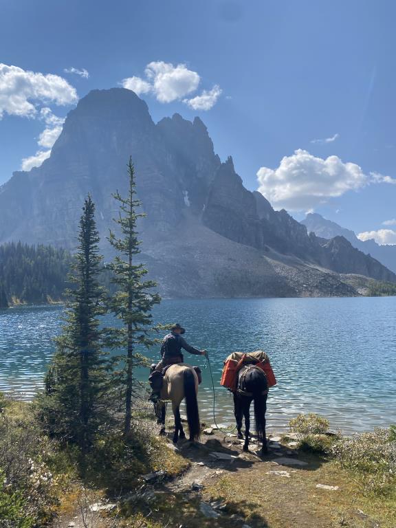
7-day loop from Simpson River trailhead in over Ferro Pass to core area. Rest day for ponies at O'Brien while we did a day hike up to the Nub and back. Grueling climb, but spectacular views. Then out via Police Meadows, back to Simpson trailhead. Be prepared to cut, or bushwhack around, fallen trees from Surprise Creek to Ferro Pass. All camps have bear lockers for food storage. Pack supplemental horse feed cuz grazing is skinny at some camps. Basic route finding required down the Simpson River from Police Meadows to Surprise Creek.


Linda B

More valuable info posted on: 04 / 05 / 2025

The Banff & Mount Assiniboine Hiking Map are suitable for trail finding and a topo map helps with the Simpson River portion as the route follows a river bed and gravel bars. Backcountry travel one may experience a variety of weather conditions, uncleared trail, minimal grazing, etc. I highly recommend Tania Millen's book Pack'em Up, Ride'em Out for valuable info on many backcountry routes including her Mt Assiniboine trip. Your best resource is doing your homework to find out who has been into the backcountry recently for the most current information to make your trip a success.


Required
Your email address will not be displayed. This is only so we may contact you if we need to clarify something in your comment.
Required
Required
Required
Note: All of our Geo-Referenced PDF maps are available for free from the Avenza from the Map Store. These maps can be used with the Avenza Maps app on GPS enabled Smartphones and tablets.

GPX Upload
Rode this trail? Show the HCBC Trail Community Which Route You Ride

HCBC monitors the integrity of the GPX files uploaded prior to posting on this website. We will contact you via your email if your track is suitable for an Avenza Map.

Name:

Email:

Please upload GPX files only.


Image Upload
Saw Something Cool? Share it with the HCBC Trail Community

HCBC monitors the integrity of all images and comments posted on this website. Please allow us 24 hours to review the Images uploaded for this trail before they appear on our website. Thank you

Please upload jpeg images only.