Monument 83 Trail

Back Country Trail
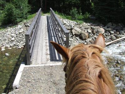
This trail in Manning Park is rated as Moderate. After leaving the parking lot the fire access road remains level for the first 3 km. After crossing the first bridge, which spans the Similkameen River, a short side trip can be made to Boyds Meadow by taking the left fork. Keeping to your right and shortly after crossing the Similkameen River the trail crosses the Chuwanten River. From this point one should keep to the left at all branches. As you will immediately see the trail starts to climb as soon as you cross over the bridge. The ascent is moderately strenuous and climbs steadily over the next 12 km. At 14 km the Centennial Trail which goes to Cathedral Lakes cuts off to the left. The last kilometre is definitely strenuous and will have you hoping the summit is reached shortly. A number of times you will believe you have reached the top only to find it is merely a plateau. However, once you are there, it is enjoyable and a nice spot for lunch on a sunny day.
Manning Park
49.054065
-120.725178
Yes
Monument 78/83 parking lot
Camp only in designated areas. Horse camps are available at Dewdney and Hope Pass trails. Visitors are requested to carry backpacking stoves and not have open fires. Unless otherwise noted on the trail description all horse camps include a toilet, fire ring, water, hitching rail and grazing.
The summit of Monument 83 stands above the timberline at 1980 m and is the location of an old 1920's B.C. Forest Service fire lookout station. This old lookout is open and offers shelter when the weather is poor. There is also a more recent fire lookout on the American side of the border built by the U.S. Forest Service in the 1960's. This is seldom used now as most fire spotting is through aerial surveillance. One unusual feature of this area is the presence of a rock-covered grave. The carved wooden headstone bears the inscription: "Pasayten Pete, shot by L.E. Lael, 26.8.61". Mystery surrounds the grave: does it contain the body of a loyal horse, a drunken rum runner, or a two-faced prospector? Nobody knows for sure! From Monument 83 the trail leaves the park, crosses the international border and enters the Pasayten Wilderness Area of the United States. The trail is not maintained beyond the border.More information including current trail conditions at http://www.env.gov.bc.ca/bcparks/explore/parkpgs/ecmanning/
Note: Also check under Upload/Download tab to see if there are more maps available. If the map below shows red lines, these indicate ridable trails which can be downloaded to your GPS (see Upload/Download tab)
Start of Trail: Monument 78/83 parking lot 2.4 km east of Manning Park Visitor Centre. The trail is NOT accessible from the Headwaters Equestrian Camp. It is approximately 3km down the highway so will need to trailer there.

Legend

Karin Smith

Monument 78/83 trail posted on: 07 / 22 / 2022

These two trails are closed until further notice as there are quite a few bridges washed out due to the atmospheric river that we had in the fall of 2021. Parks are working on getting the bridges replaced


Required
Your email address will not be displayed. This is only so we may contact you if we need to clarify something in your comment.
Required
Required
Required
Note: All of our Geo-Referenced PDF maps are available for free from the Avenza from the Map Store. These maps can be used with the Avenza Maps app on GPS enabled Smartphones and tablets.

GPX Upload
Rode this trail? Show the HCBC Trail Community Which Route You Ride

HCBC monitors the integrity of the GPX files uploaded prior to posting on this website. We will contact you via your email if your track is suitable for an Avenza Map.

Name:

Email:

Please upload GPX files only.


Image Upload
Saw Something Cool? Share it with the HCBC Trail Community

HCBC monitors the integrity of all images and comments posted on this website. Please allow us 24 hours to review the Images uploaded for this trail before they appear on our website. Thank you

Please upload jpeg images only.