Swift Current Creek Trail-Robson Park

Day Ride Trail
This trail is within Mount Robson Provincial Park. Prior to travel, Refer to Mount Robson Provincial Park in HCBC trails database. The trail starts from the end of Howard Road and follows an old road for a short distance. When you reach the creek, the trail takes sharp right turn up a short but very steep hill. The trail then levels out as you ride through thick forest. Just before you reach the Swift Current Creek Gravel flats there is a long boardwalk to the creek.PICK A SAFE CROSSING and from this point on, the route follows gravel flats and side bank trail to the end of the gravel flats. PLEASE SEE NOTES FOR DETAILED TRAIL DESCRIPTION AND CAUTIONS.
Valemount, Tete Jeune Cache, McBride
Refer to Mount Robson Provincial Parks in HCBC Cariboo North East trails database
8 to 11 km
approx 200 metres
2.25 hours to Poplar Point lunch stop and approximately 45 minutes further to end of gravel flats
53.01775
-119.28438
Plenty or water as route follows a creek
Small paved parking area suitable for four 4-horse trailers at cul de sac at end of Howard Road, and additional parking available along side of Road.
N/A
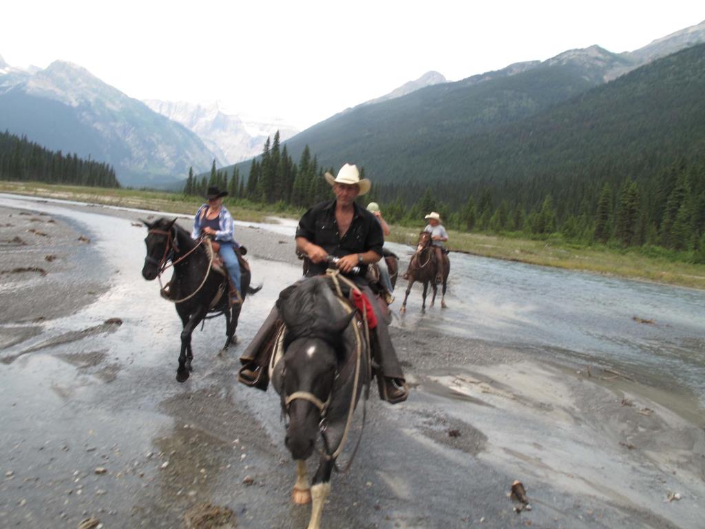
The trail starts out with a steep, but short, hill. From the top of the hill, the trail levels out and is easy travel for approximately one hour, when you will reach boardwalks across a wet area. Take caution on the boardwalks as they may be slippery - DISMOUNT and walk the horses over all boardwalks. The first crossing of Swift Current creek is immediately after the boardwalks. Take CAUTION as this creek is true to it's name, Swift current! THIS FIRST CREEK CROSSING MAY BE IMPASSIBLE IN HIGH-WATER. (usually June and July). You must choose your crossing wisely at any time, however, as the creek, is glacier fed. Intense sun or rain may cause the creek to 'swell' at anytime. It is strongly suggested to ride with some of the locals who are familiar with the creek. Travel upstream after this first crossing. Travel from this point forward becomes a route, as there is not a distinct trail to follow as you travel upstream on the gravel bars and cross the braided creek bed multiple times. You and your horse will be well schooled in water crossings after this ride. As you travel upstream, the valley widens and the scenery is magnificent with the amazing Mount Longstaff towering over the end of the valley. At this point, you can opt to travel on solid ground on the right-hand side bank where you will follow an old trail through brush and overgrown willow. Travel as far up as you wish. The aspen grove, (often referred to as poplar point), a popular lunch spot, is approx. 1.5 hours up from the boardwalk on the right-hand side of the creek. After the aspen grove, you may wish to continue up the creek along the gravel flats or explore the meadows on the opposite side of the creek where an old mill site is located. Eventually, (in approx. 45 minutes travel), you will run out horse travel options. The Creek narrows into a canyon and a rock bluff on the left prevents further horse travel. To return, retrace your steps back to the staging area (walking your horse down the steep hill at the end).
Note: Also check under Upload/Download tab to see if there are more maps available. If the map below shows red lines, these indicate ridable trails which can be downloaded to your GPS (see Upload/Download tab)
Turn North off Highway 16 at Howard Road (14 km east of Tete Jaune Cache junction immediately EAST of the Swift Current Creek Bridge). The trail head is located approx 1/2 km down Howard Road.

Legend

Required
Your email address will not be displayed. This is only so we may contact you if we need to clarify something in your comment.
Required
Required
Required
Note: All of our Geo-Referenced PDF maps are available for free from the Avenza from the Map Store. These maps can be used with the Avenza Maps app on GPS enabled Smartphones and tablets.

GPX Upload
Rode this trail? Show the HCBC Trail Community Which Route You Ride

HCBC monitors the integrity of the GPX files uploaded prior to posting on this website. We will contact you via your email if your track is suitable for an Avenza Map.

Name:

Email:

Please upload GPX files only.


Image Upload
Saw Something Cool? Share it with the HCBC Trail Community

HCBC monitors the integrity of all images and comments posted on this website. Please allow us 24 hours to review the Images uploaded for this trail before they appear on our website. Thank you

Please upload jpeg images only.

Geo-Ref maps for Avenza Maps App on mobile devices

Note: If you are on a computer, you can print these maps. If you using a mobile device, then these maps are available to download from the Avenza Map Store within the Avenza app.